Vnanje Gorice (Vnanje Gorice)
Vnanje Gorice (Außergoritz ) is a settlement 5 km south of the capital Ljubljana in central Slovenia. It is located in the Ljubljana Marsh landscape park. The entire Municipality of Brezovica is part of the traditional region of Inner Carniola and is included in the Central Slovenia Statistical Region.
The name Vnanje Gorice literally means 'outer hills', referring to a cluster of hills in the Ljubljana Marsh: Plešivica Hill, Big Peak (Veliki Vrh), Gulč Hill, and others. The name distinguishes the settlement from neighboring Notranje Gorice (literally, 'inner hills') to the southwest. The name is derived from the Slovene common noun gorica 'hill', a diminutive of gora 'mountain'. The settlement was known as Außergoritz in German in the past.
The name Vnanje Gorice literally means 'outer hills', referring to a cluster of hills in the Ljubljana Marsh: Plešivica Hill, Big Peak (Veliki Vrh), Gulč Hill, and others. The name distinguishes the settlement from neighboring Notranje Gorice (literally, 'inner hills') to the southwest. The name is derived from the Slovene common noun gorica 'hill', a diminutive of gora 'mountain'. The settlement was known as Außergoritz in German in the past.
Map - Vnanje Gorice (Vnanje Gorice)
Map


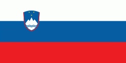
Country - Slovenia

Currency / Language
| ISO | Currency | Symbol | Significant figures |
|---|---|---|---|
| EUR | Euro | € | 2 |
| ISO | Language |
|---|---|
| SL | Slovene language |